We offer a range of survey solutions specific and tailored to the construction and property sectors
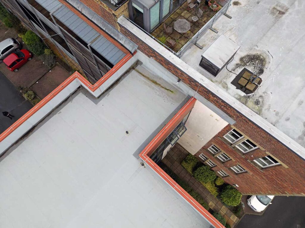
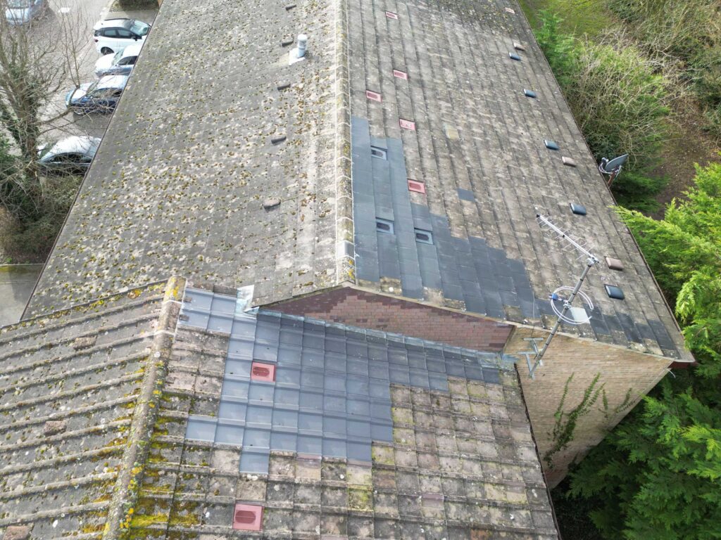
Roof Condition Surveys
We specialise in providing high quality, cost-effective roof surveys to residential property management companies.
We capture hi-res data and deliver a mission-specific, dynamic condition report together with a full image data set and targeted action advice for every roof.
Our in-house surveyors and drone pilots, together with our multi-asset pricing model, allow us to offer our clients a per unit survey cost that is usually far cheaper than traditional surveyors.
Our approach enables residential property management companies to fulfil their insurance compliance and SLA obligations far more safely and cost-effectively, whilst providing valuable insight into their roof spaces.
Snagging Surveys
A visual inspection and analysis of property work to identify defects and assess workmanship quality against agreed-upon standards.
We inspect exterior property works, and can also inspect interiors upon request. We look for snags (faults), which can range from minor cosmetic imperfections through to more significant functional issues, and offer potential rectification solutions.
We compile a report listing all identified snags. We capture ultra hi-res images, describe each issue found, and locate it exactly via a visual location map that enables immediate identification for contractors to carry out defect resolution.
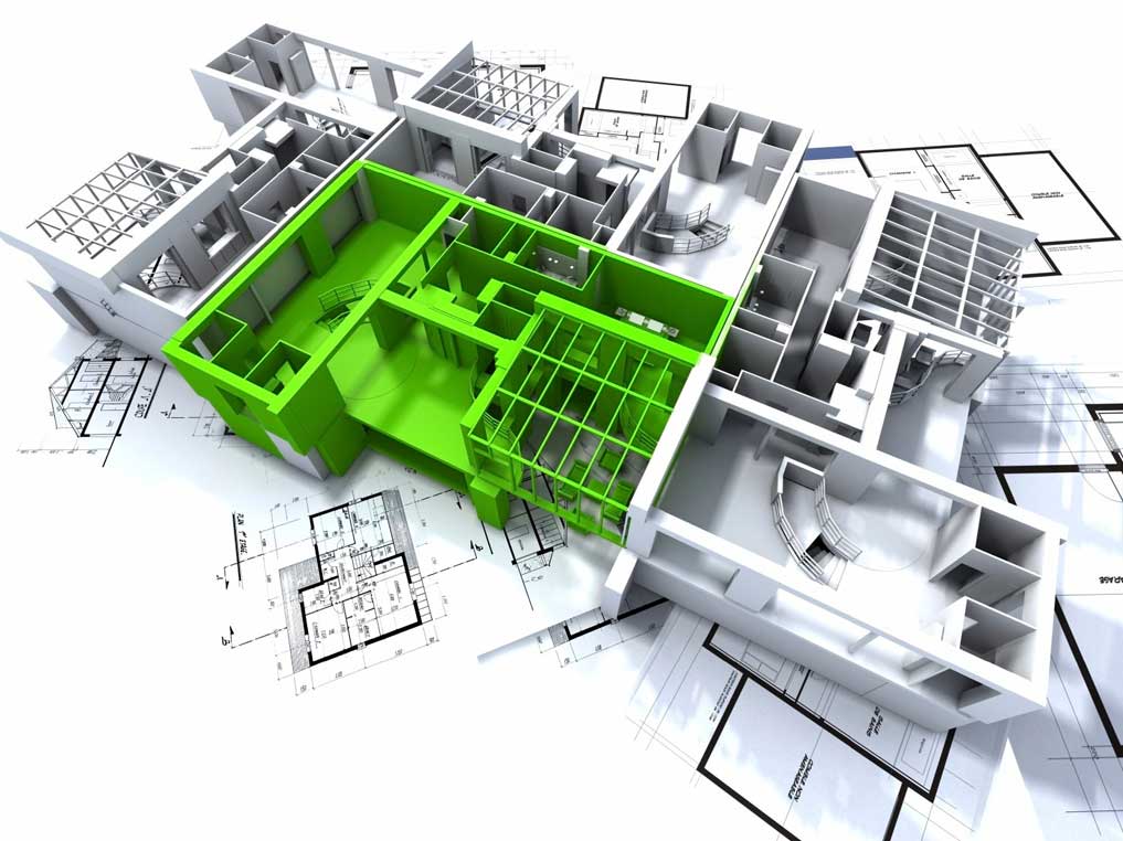
Measured Building Surveys
Capture of data points using a 3D laser scanner to acquire highly accurate measurements of a building or structure.
3D laser scanning captures data that enables the creation of highly accurate measurements (distances, areas, volumes, slopes, and even 2D outlines can be extracted from the point cloud), 3D models (the point cloud can be converted into a 3D model for further analysis, design, or creating virtual walkthroughs), and scan to BIM (the point cloud data can be used to create a BIM model).
Measured building surveys are useful for capturing existing conditions, monitoring progress, creating as-built 3D models, documenting features, generating floor plans, facilitating BIM workflows, and creating digital twins for space planning, asset management, and maintenance.
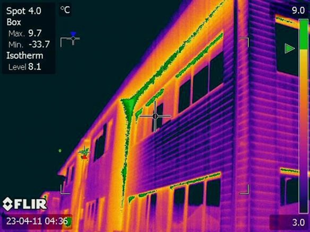
Thermal Imaging Surveys
Our thermal imaging surveys are carried out by our in-house category 1 qualified aerial thermal inspection team.
Thermal imaging offers a fast, cost-effective and highly accurate method for identifying building performance issues that are often not visible to the naked eye, while also being a non-destructive process.
Thermal imaging technology visually identifies missing and insufficient insulation, air leakage, moisture and water ingress, and many other construction defects that can materially affect the overall performance of a building structure.
With energy saving becoming a priority for many property stakeholders, thermal imaging is set to play a material role in construction and property management.
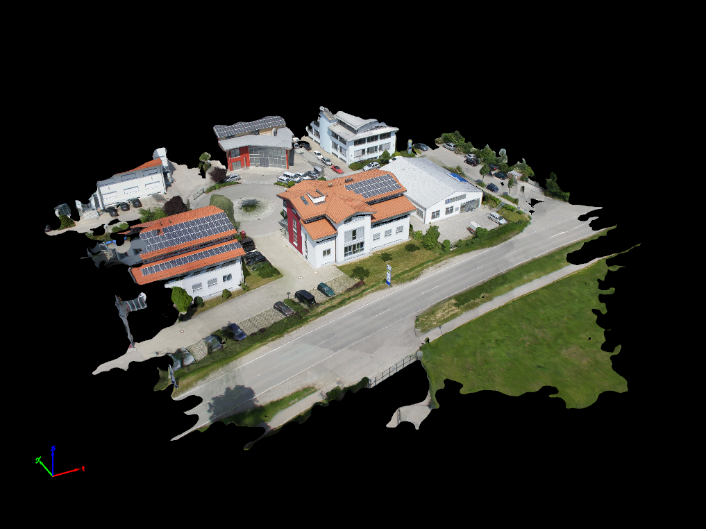
Photogrammetry Surveys
Photogrammetry surveys extract spatial data from photographs to create accurate measurements and 3D models of real-world objects and environments.
Applications include:
3D Modeling: Highly detailed and realistic 3D models are generated for various purposes, including building preservation and engineering design.
Volume Calculations: Stockpile volumes, excavation depths, and other volumetric measurements can be derived from the 3D point cloud data.
Change Detection: By comparing photogrammetric data collected at different times, changes in a site can be monitored and quantified.
Mapping: Orthophotos and DEMs are valuable base layers for creating topographic maps and for integrating with Geographic Information Systems.
CAD/ REVIT Data Capture
Acquisition of data at LOD 1/2/3 level of detail for facilitation of BIM model creation to meet requirements of 2D CAD drawings/ 3D Revit models.
LOD 1, also known as ‘basic building block’ representation, is suitable for feasibility studies and preliminary space planning where precise details are not critical.
LOD 2 adds major building elements like walls, floors, roofs, doors, and windows and includes dimensions and basic material information, and is suitable for design development and construction documentation phases.
LOD 3 adds a high level of detail, specific materials, systems, and components. This level enables facility management and maintenance tasks by providing a comprehensive digital record of the building’s components.